Trip to Lake Powell: Coral Pink Sand Dunes

14 March 1984

On the way back home from our trip to Lake Powell, we stopped to check out Coral Pink Sand Dunes State Park.  Established in 1963, the park covers 3,730 square miles (9,660 sq km).  Estimated to be 10,000 to 15,000 years old, the dunes are formed from the erosion of the pink Navajo sandstone in the cliffs surrounding the park.  A notch between the Moquith and Moccasin mountains funnels the prevailing winds, increasing their velocity to a point where they can carry sand grains in what is called the Venturi Effect.  When the winds lose speed, they drop the grains of sand they’re carrying and voila, the dunes are born.

It was cold and the wind was blowing, so we didn’t play long in this giant sandbox, but we did climb a dune or two while we were there.

Trip to Lake Powell: Nonnezoshie

13 March 1984

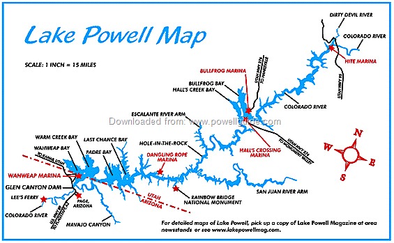
The Navajo knew Rainbow Bridge as Nonnezoshie — a rainbow turned to stone.  Considered to be the world's largest natural bridge, this rock arch spans Bridge Creek.  Located deep inside a canyon that branches off Lake Powell, the bridge is 290 feet (87 m) tall, spans 275 feet (82.5 m), is 33 feet (10 m) wide and 42 feet (13 m) thick.

According to Navajo lore, a handsome young god went hunting in the ruggedly beautiful red and purple canyon, only to find himself trapped by a raging flash flood.  The great Sky Father took pity on the young god and threw down a rainbow on which the spirit climbed to safety.  Beneath the traveler’s feet, the rainbow turned to stone.  And so it remains, a reminder of the Sky Father’s benevolence.

Here’s a bit of information about Rainbow Bridge from Glen Canyon-Lake Powell — The Story Behind the Scenery, a booklet I picked up during our trip:

In 1863, during the Kit Carson campaign against the Navajo, a small band of Indians under the leadership of Hoskininni went into hiding in the slickrock desert around Navajo Mountain.  One of this group, Jaa’i Bighe, a singer or medicine man, came upon the bridge.  Struck by the singular appearance of the bridge, the group felt that there was a strong connection between the sacred Head of Earth (Navajo Mountain), which was a cloud maker, the frozen rainbow of stone, and life-giving rain.  A ritualized series of rites, chants, and offerings were developed around pilgrimages to the bridge.  Most Navajos, however, avoided the area because of its strong supernatural powers.  To pass under the bridge without chanting the correct songs would mean certain death.

History records that in 1909, Nashjah Begay, a Paiute scout, guided a group that was headed by William B. Douglass.  Douglass was determined to be the first white man to ride under the bridge, but his pre-occupation caused him to miss sighting the bridge when they rounded the corner and that honor went to John Weatherill instead.

The plaque reads: “To commemorate the Paiute Nasjah Begay who
first guided the white man to Nonnezoshi … August 1909.”

The small sign below the plaque in the above photo is a correction and reads as follows:

In recent years, it has been learned that a Paiute Indian named Mikes Boy saw Rainbow Bridge before Nasjah Begay did.  When the two white discovery parties were searching for the bridge in August of 1909, one was led by Nasjah Begay and one by Mikes Boy.  The two joined forces and rediscovered the bridge together.

About a decade before, Mikes Boy had shown Nasjah Begay where the bridge was after having discovered it himself while herding horses.  Three-quarters of a century later, the National Park Service honored the Paiute, now known as Jim Mike, with a ceremony here at Rainbow Bridge.  In 1977, Jim Mike died and was buried in Blanding, Utah.  His friends believed him to be 105 years old.  (In the signage photo, Jim Mike is 101 years of age.)

Collage of Google Maps satellite images showing Rainbow Bridge.

Our visit to Rainbow Bridge has been a lasting memory.  We hope to revisit this grand monument again someday.

Trip to Lake Powell: Rainbow Cruise

13 March 1984

There is something in the harmony of sky and rock and water — something that ensnares the soul in the flow of time.  In the mystical canyons of the Glen, grasp infinity in the palm of your hand. 
Find eternity in an hour.

From: Glen Canyon-Lake Powell  The Story Behind the Scenery

This was the day of our Rainbow Cruise on Lake Powell.  We had a beautiful day for the 100-mile (160 km) roundtrip cruise.  Our boat trip took us to several points of interest hidden in the nooks and crannies of what used to be Glen Canyon, including its most prominent feature — Rainbow Bridge (see next blog post).

[Click the map for the “Official” Guide for Lake Powell]

Of the 11 rolls of film Mui shot on this trip, most were taken during this cruise.  In those pre-digital days of photography, that was quite an investment for a 5-day trip!!!

We boarded our boat at Wahweap Marina.
(Wahweap is a Paiute word that means bitter or bad water.)

Castle Rock represented Mt Sinai in the movie The Greatest Story Ever Told,
which was filmed before the canyon was flooded.

Gunsight Butte was the scene of the flight from Egypt to Jerusalem
in the movie The Greatest Story Ever Told.

The first 35 minutes of the Planet of the Apes was filmed on this mesa.

Can you find the boat in the rock?

Left: This formation is characterized as the Needle and Eye.
right: the needle

The Eye

Forbidding Canyon
the local indians knew navajo Mountain (on the left) as the head of earth.

Forbidding Canyon

Whiskey Cave  was named for its obvious hangover!

Dangling Rope Canyon was initially named Hanging Rope Canyon
for the ropes that miners used to lower themselves to the canyon floor.

It was a great day for a water tour of Lake Powell.

Trip to Lake Powell: Glen Canyon Dam

12 March 1984

Lake Powell, located within Glen Canyon National Recreation Area (GCNRA), is the second largest man-made reservoir in the US.  (Lake Mead in the largest.)  Both the lake and the GCNRA were created when Glen Canyon was flooded after the construction of a dam over the Colorado River.  Though the lake straddles the state line between Utah and Arizona, most of it lies within Utah.  It was named for explorer John Wesley Powell, a one-armed American Civil War veteran who explored the river in 1869.

Google Maps Satellite view of Lake Powell and the GCNRA.
(Page, Arizona and the glen canyon dam in the lower left corner;
rainbow bridge right of the center.)

Here’s a bit of Glen Canyon history from a note in my album (I’m afraid I didn’t indicate the source of the information):

The first written record of Glen Canyon is found in the journal of Father Escalante whose exploring party floundered for several days at the edge of the barrier.  When they reluctantly decided to return to Santa Fe, it was only to encounter more difficulty and hardship on their homeward bound journey.  On October 26, 1776, they reached the Colorado River at Lees Ferry.  Laboriously, they climbed cliffs and walked through deep sand…scouting a ford.  On the night of November 2, they camped along Wahweap Creek (near the present location of Wahweap Lodge).  On November 7, they chopped steps in the sandstone wall at Padre Creek and safely arrived at the banks of the Colorado.  This location is now known as “Crossing of the Fathers.”

The name Glen Canyon, however, we owe to John Wesley Powell who observed numerous “glens” along the banks of the Colorado.  As an early advocate of water reclamation, his name is certainly most appropriate for the lake that now fills Glen Canyon.

Basing ourselves in Page, Arizona, we spent the first day getting acquainted with our immediate environs.  We stopped at a few overlooks to view Lake Powell from above and then went down to the banks of the lake to get a different perspective of the scenery.

View of Lake Powell from Arizona.

Mui sets up his new SLR camera on ...

… Lone Rock Beach on the Utah side of Lake Powell.

Easy to tell where Lone Rock Beach gets its name.

Later in the day, we visited Glen Canyon Dam, the second largest dam on the Colorado River.  Located near Page, Arizona, the dam is as controversial now as it was when construction began in 1956.  Total cost of the project was approximately $272,000,000.  The dammed water started to fill the reservoir on March 13, 1963, and reached it’s maximum elevation of 3,708 feet (1,112 m) in July 1983.

The site of the Glen Canyon Dam was chosen because the canyon
at this point was not only narrow, but there were also no faults nearby.

(OK, I admit … I added us to the photo after the fact!)

Glimpse of the Colorado River from the crest of the dam.

It’s 716 feet (213 m) from the crest to the bottom of the dam.

Our tour took us to the bottom of the dam …

… and gave us a glimpse into the generator room.

Several months after our trip, I came across this image that I found interesting … mostly because of our recent visit to Lake Powell.  Here’s a bit from Wikipedia that further explains:

The winter of 1982–1983 provided a deep snowpack over much of the watershed behind the dam.  This was followed by an exceptionally wet early spring.  In May, there was a quick rise in temperatures.  All of these factors combined to create perfect conditions for maximum runoff in the Colorado River basin.  By early June, the river was rapidly filling Lake Powell.  By late June, even with the powerhouse running at full flow capacity and opening bypass jet tubes, the sustained inflow of over 100,000 cu ft/s (2,800 m3/s) required using the spillways for the first time.

Lake Powell spills for the first time.
[scanned from a magazine; source unidentified]

Trip to Lake Powell: Getting There

11 March 1984

In early March, wanting a change from snow and cold weather, we headed south.  Our destination was Lake Powell, located within the Glen Canyon National Recreation Area.  We took a roundabout way to get there, driving to St  George, in southern Utah, and cutting through Zion National Park.  This route added 80 miles (128 km) to our drive, but it was worth it to get a quick glimpse of one of the nation’s premier national parks.

We covered 880 miles (1408 km) on this trip.

After overnighting (I think) in St George, we dallied just long enough the next morning to take photographs of the first LDS (Mormon) temple that was built in Utah.  Constructed between 1869-1877, it cost $1,000,000.  I don't want to even try to calculate what that would be in current-day dollars, but the white-plastered building was stunning against the deep blue sky.  (Click here for more information.)

Zion National Park (ZNP) is the result of millions of years of upheaval and the erosive forces of wind, rain, frost, and the Virgin River, which combined to cut through the layers of Navajo sandstone.  The 2,000 feet (610 m) deep canyon is one of the spectacular features of the park.  Our first visit to ZNP, which was named Mukutuweap until the name was changed to Zion in 1918, was necessarily brief.  We drove in through the East Entrance and went out through the South Entrance.  We made a few stops along the way to enjoy the towering cliffs, but that was pretty much all that we had time to do.

TEMPLES AND TOWERS OF THE VIRGIN
(1) West Temple; (2) Sundial; (3) Altar of Sacrifice

“There is an eloquence to these forms which stirs the imagination with a
singular power, and kindles in the mind a glowing response … Nothing
can exceed the wondrous beauty of Zion Valley” — Clarence E. Dutton, 1882

Court of Patriarchs

Weeping Rock

Mud deposited in lowland streams millions of years ago was covered with
windblown sand.  Centuries of pressure squeezed the mud into thin shale
layers and the sand into thick sandstone.  Water passes easily through
sandstone but not shale.  The moisture soaks into the sandstone and when it reaches
the shale, it moves sideways to emerge onto the face of the cliff as a spring.

Hoodoos are eroded surfaces of Navajo sandstone.
The rock formation near the trees on the right is a hoodoo in the making.

the checkers (or biscuits) that groove the surface of Checkerboard Mesa
are formed by weathering of horizontal bedding planes and vertical cracks.

The quick drive through ZNP whetted our appetite for exploring the park.  Subsequent years found us returning to do just that.